The Sundered Expanse Art Print, vintage fantasy map, engraved cartography, study or library decor, gift for map lovers
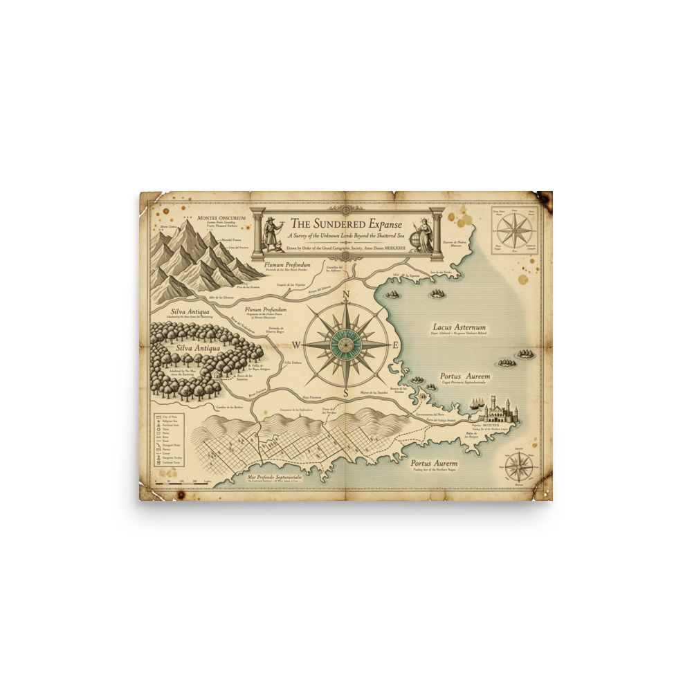
The Sundered Expanse is a vintage fantasy cartography map rendered in a 17th-century hand-drawn style, with an ornate compass rose, engraved mountain ranges, ancient forests, winding rivers, and coastal cities in sepia and muted teal. Printed on Enhanced Matte Paper (189 g/m²), its aged parchment texture and copperplate labels bring old-world character to a study, library, or thoughtful gift for map lovers.
The eye meets a broad field of warm sepia, crossed with muted teal water and carefully balanced around an ornate compass rose. Coastlines break into bays, inlets, and narrow promontories, while winding rivers draw the gaze inland toward clustered settlements and mountain chains. The land is built from fine, engraved lines: ridges gather in repeated hatching, forests form dense irregular masses, and roads or borders trace delicate paths across the surface. Copper-toned labels sit among the terrain in small, formal lettering, giving each region the measured presence of a place recorded by hand. At the edges, the map’s coastal cities punctuate the quieter stretches of land with compact marks and architectural details. The palette stays restrained, pairing parchment-like tan with weathered brown, blue-green water, and darker ink lines rather than bright modern colour. Its aged surface and fine linework make the composition feel discovered in a cabinet, where every inlet, range, and named settlement invites a closer look.
This visual language belongs to the tradition of early modern European mapmaking, translated here into a fantasy landscape. Its 17th-century character appears in the combination of decorative navigation imagery and practical geographic detail: the compass rose is both an orientation device and a central ornament, while the terrain is described through engraved hatching instead of painted volume. The mountain ranges rise as overlapping, tooth-like forms, and the forests are rendered as symbols rather than realistic tree studies, echoing the compact vocabulary used by historical cartographers to fill an unfamiliar country. Copperplate-style labels reinforce that period feeling, with narrow lettering arranged directly across the land and around the waterways. The result is a map that balances information and atmosphere. It can be read from a distance as a layered landscape of coast, forest, river, and stone, then examined up close for the smaller marks that suggest roads, borders, names, and settlements.
On the wall, The Sundered Expanse suits spaces built for reading, planning, or quiet looking: above a writing desk, beside a bookcase, over a console in a study, or among framed maps and landscape studies in a library. A dark wood frame can draw out the brown ink and aged parchment tones, while a simple black or warm brass frame will keep attention on the compass rose and the pale teal waterways. It works well where the wall has muted surrounding colours—cream, clay, olive, charcoal, or deep blue—so the map’s restrained palette can remain distinct without appearing isolated. Soft daylight brings out the fine engraved lines and the contrast between land and water. In the evening, warm directional light from a desk lamp or wall sconce gives the sepia areas a deeper, more archival tone; avoid placing it where strong glare falls directly across the surface. Hung at eye level, it offers a detailed focal point for a study or library, and a thoughtful choice for someone drawn to imagined geographies, old-world lettering, and the quiet order of cartography.
| Material | Enhanced Matte Paper (189 g/m²) |
| Digital printing | |
| Care | Frame or mount out of direct sunlight; wipe gently with a dry, soft cloth. |
| Shipping | Made to order — ships in 2–5 business days |